
 Air Quality Subcontractor #CMP029123
The high country of Arizona offers a cool escape from the desert heat. At the heart of this paradise lies the White Mountains trail system. This network features over 200 miles of multi-use pathways. These trails weave through the beautiful Apache-Sitgreaves National Forests. Therefore, this system provides incredible opportunities for hiking and mountain biking. Furthermore, the White Mountains trail system represents the best year-round recreation in Eastern Arizona.
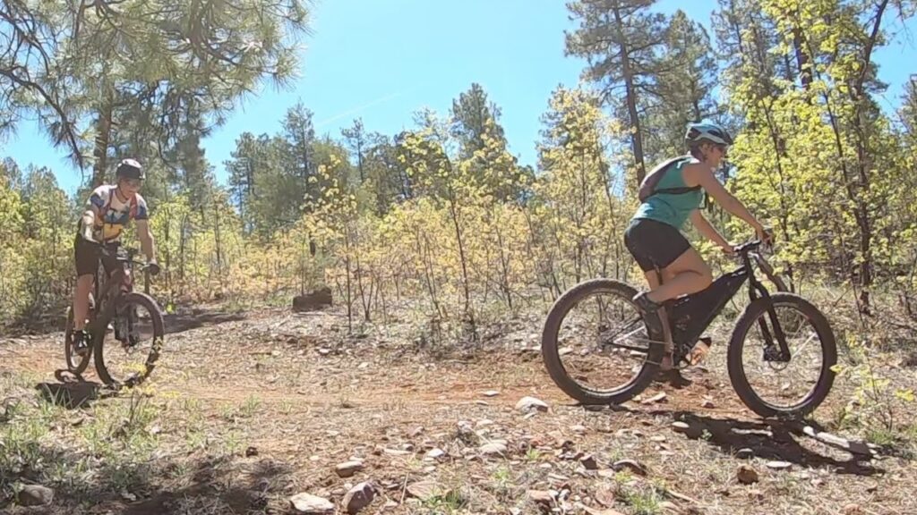
Riders will find an exciting mix of singletrack trails. These paths wind through massive Ponderosa pine forests and aspen groves. Additionally, the trails suit all skill levels perfectly. At an average elevation of 7,000 feet, intermediate trails offer a great workout. For example, the 8-mile Panorama Loop delivers rewarding climbs and fast descents. Meanwhile, popular loops like the 13-mile Los Burros cater to advanced riders.
Exploring the White Mountains Trail System
Local volunteer groups meticulously maintain the entire White Mountains trail system. Specifically, the TRACKS organization works hard to keep paths clear. Their efforts create an amazing network of interconnected trails. Consequently, families can enjoy gentle meadow strolls. Alternatively, experienced mountain bikers can tackle challenging single-track climbs. The trails traverse elevations ranging from 6,000 to 9,000 feet. Because of this high altitude, visitors must hydrate properly.
For hikers, the White Mountains trail system offers an idyllic journey. You will walk through the largest continuous Ponderosa pine forest worldwide. The sheer variety of terrain will amaze you. First, you might wander through dense spruce groves. Next, you could emerge into a vast, sunlit juniper meadow. Furthermore, builders thoughtfully designed these trails with numerous loops. Therefore, adventurers can easily customize their distance and difficulty. Safety remains a top priority here. Every quarter mile, crews install a reflective marker with GPS coordinates. This detail helps emergency responders locate you quickly.
Building Near the White Mountains Trail System
Many visitors decide to buy property near the White Mountains trail system. However, proper site preparation remains crucial for mountain land. Mountainous terrain requires specific land grading and soil testing. These steps ensure a stable foundation and proper drainage. Before you break ground, you must evaluate utility access carefully. Remote parcels often need off-grid solar setups or well drilling. Additionally, steep inclines require careful driveway prep and graveling. This preparation keeps your property accessible during winter snows.
To navigate these complexities, we highly recommend reviewing comprehensive land due diligence reports. Furthermore, you should always check local zoning laws. You must review Arizona state land regulations before building. This step ensures your plans align with county codes.
Top Routes in the White Mountains Trail System
Many people access the trails near Pinetop-Lakeside. Here, trails like the Land of the Pioneers form the central system. For instance, this intermediate trail offers a beautiful 8-mile journey. Meanwhile, the Los Burros trail stretches for 13 miles. This route provides a challenging hike or an intense mountain bike ride. Additionally, the Show Low trail system connects to the greater network. The Buena Vista Trail offers a 12-mile loop with difficult sections. Therefore, it provides a great challenge for cyclists and hikers.
The region earns a strong reputation for high-quality single-track riding. The challenging elevation attracts cyclists of all skill levels. Furthermore, the non-motorized rules ensure a quiet, nature-focused experience. Events like the Tour of the White Mountains draw hundreds of riders. These cyclists test their skills on fast, flowing descents. Because the White Mountains trail system spans over 200 miles, you must plan ahead. Always consult official maps before you start your trip. Ultimately, this region provides a vast stage for your next outdoor adventure.